Backcountry Campsites
Backcountry permits are issued for each of the named designated 16 backcountry campsites. Reservations on-line are a must, especially in spring and fall.. Refer to the chart below and our descriptions for correct listings/capacity and location of sites and photos. There is only one fire ring per site now. Thus, only one permit per site for individual, couples or small group. Walk-in/non reservation permits are still issued at the park office on first come basis for sites not reserved already.
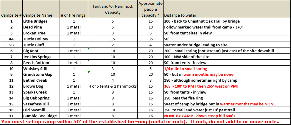
Groups, pay attention and choose a site according to how many tents/hammocks a site can handle per Site Descriptions chart.
The individual Backcountry permit fee as of 11/1/2022 is now $12.00 per night per person up to a group of 5. For a group/family or organization permit for 5 or more the fee is $60.00 per night. In addition to the backcountry permit, you will still need to purchase a one-time daily parking permit for every car parked on park property. Thus you will only have to pay for one permit (ie $5) for each vehicle regardless if you stay one night or several days.


|
On the chart, capacity mean number of TENTS/and or HAMMOCKS based on 1-2-3 persons per TENTS/and or HAMMOCKS with still a max capacity of TENTS/and or HAMMOCKS as shown on the chart. NOTE: So where ever you see the word "tent" in the descriptions below or other sections of this website, note that since hammocks take up about the same space so number of "tents" actually
means TENTS/and or HAMMOCKS . |
Below is a description of 16 designated backcountry campsite areas along the trails. Camping is by permit only (and you must obtain your actual backcountry permit AT THE PARK OFFICE at least two hours before dark even if you have reservations). You must camp only in the designated named campsite areas you have a permit for. See PERMITS for how to make reservations in the backcountry. As of December 6, 2018 individuals and groups were able to make online site-specific reservations. All sites now only have one fire ring. But all sites are single permit/fire-ring sites meaning one permit for one person, couple or small group (thus you will never have to share a site). If you don’t have a reservation, choice of available campsites is first come basis of sites that may be available on the day
you arrive at the park office.IMPORTANT: you must be off the trail hiking to sites before dark.
Each campsite is slightly different in size and capacity. Once you obtain your permit for the named sites, you must stay at the site or sites listed on your permit. Should you decide to NOT stay at a site, let the park office or rangers know. What happens if you say “poop out” and get to say Sparks Creek Campsite
and no one it there, and you have a permit for Brown Dog? You may call the park office during office hours and request (if available/ not permitted out) to stay at Sparks and clerks may change your permit verbally. Again, this must be done (call/seek permission during office hours) before you change sites..
Please do NOT move a fire-ring, add to/alter or build new ones. You must set up camp (tents and hammocks) near/within 50’ of the fire-ring. Build fires with dead, down on the ground wood: no cutting/sawing/carving of or on any size standing trees, dead or living. What do you do if you want to cook hot-dogs or roast marshmallows? Bring a skewer from home! Whiskey Still, Sassafras Hill and Grindstone Gap have little if any water nearby during warmer months. Be very cautious if you have a campfire at those sites and drown all campfires with about 3 gallons of water (if there is no water nearby, no campfire). Sassafras Hill Campsite does not have water nearby often.
Ga State Park rules state NO alcohol consumption at all in the park except inside rental cabins & RV’s, so there is no drinking period in the backcountry (along the trail and campsites) nor at road side picnic areas and trailheads. If you need to cut up small dead/downed wood, bring a small folding hand saw. Pack out all your trash and help by taking out any left by others. NOTE: if you come to a campsite and find trash/left equipment in the camp or a smoldering fire, PLEASE call the park emergency number to inform the manager/ranger on duty (text/send them photos if requested and help by cleaning up trash if possible). Also call and send photos of same to Jim Hall with PMTA at 706-325-4113 or email to pinemttrailassoc._jim@msn.com .....NOTE: If you leave a campsite with trash or smoldering fire, you can be assumed to have left it and as the last permitted person there can be cited. Campsites are regularly checked by park rangers and PMTA volunteers. Lastly, don’t build nor leave ANY “wilderness beds”/tables etc.” Leave a site better than you find it. PLEASE only burn wood in a campfire and don’t try to melt down/burn any aluminum foil, metal cans, glass, plasticware (they are trash and haul it out.) No CHARCOAL either as it does not burn down well. Please don’t put candles on rocks by campfires either. At the time you obtain your backcountry permit, you will be offered a trash bag if you don’t have one.
Here is a link to one page of information on Backcountry Camping you may want to review as an individual/couple or pass along to those coming with you in a group.
While reading these descriptions, it is best to have an actual PMT topo style map in front of you. Maps are available from the PMTA on this website and the park office..
1) Little Bridges Campsite - one fire ring (click here for more info)
This campsite is located on the Chestnut Oak Trail just off the main PMT. You can get to this site from the west end of the Chestnut Oak Trail by parking across from the Gardens Country Store, hiking up Ga 190 a short ways to the rock wall entrance way of FDR State Park on the left. The Pine Mountain Trail sign is on the south side of the road on the right. Look for a sign for the Chestnut Oak Trail on your left (north side of the road). Hike the Chestnut Oak Trail east 1.7 miles to the campsite. (The entire Chestnut Oak Trail is 2.1 miles long.) OPTION: If you start off on the main PMT and come to Mile 1.4 at the Garden Overlook Parking Area, you cross GA Hwy 190 to the north. Just after you cross the road, there is a junction with the white blazed Chestnut Oak Trail that goes to your left (west). Little Bridges Campsite is located just down the mountain 4/10 mile from this junction. Large hardwoods are all around this beautiful camp. This camp was built to allow backpackers a close first or last night's camp. The distance to GA 190 will make it a good choice for first time backpackers or those with younger campers. There is a nice year-round spring beside the camp entrance that runs under a little bridge. This is a single fire ring site.
2) Dead Pine Campsite (click here for more info)
This is the first site on the main PMT starting from the west end. The site is located east past Mile 2 about 4/10 of a mile. You can also hike to the campsite from "No Name Parking Lot" which is only about a one half mile hike. From "No Name Parking Lot" there is a sign directing you to the Pine Mountain Trail via a dirt road off/away from the parking lot. After hiking this road a short ways you will pass the red blazed Mountain Creek Trail (which crosses the road) and you continue on uphill until you see the wooden Pine Mountain Trail directional sign. Turn right (west) there onto the blue blazed PMT. You will pass over the dam of the large CCC Hatchery Pond and continue on until you see the campsite sign on your right. From there to the camp is a white blazed 265' trail. The water source is from a spring some 370' from the campsite via a marked trail with sign. There is just one metal fire ring at the area of the campsite. The old main campsite area is noted a being closed off to allow regeneration due to compaction/bare ground. This site is a 5 tent 10 person site, and has a number of trees which is good for hammock campers. NOTE: DO NOT add rocks around the metal fire ring nor move it and even though the metal fire ring has a cooking grate, still NO CHARCOAL use in the backcountry (it doesn’t go away, just use dead downed wood).
3) Broken Tree Campsite - one fire ring (click here for more info)
This campsite is located 1.4 miles east from the FDR Park Office on the main PMT. On this route you cross paved roads twice before you reach the camp just east past Mile 5 marker. If you park at Fox Den Cove Parking Lot, cross GA 190 and follow the PMT back to the west. Broken Tree Campsite is 6/10 of a mile west of Mile 6. The camp is on south side of the trail (heading east) in a small bottom just before you start back uphill. There is wooden sign on your right. This is a small camp for three tents at the most. In winter this is a warm camp, as a hill north of it should block the wind. There is an ample supply of downed, dead wood for campfires. There is a year-round spring right on the edge of the camp. This is a single fire ring site, meaning only one person/couple or small group of about 6 will be issued a permit for this 3 tent site.
4 & 5) Turtle Hollow & Turtle Bluff Campsites - one fire ring at each (click here for more info)
The start of the access trail to Turtle Hollow Campsite is 1.4 miles east of Fox Den Cove Parking Lot on the Pine Mountain Trail. From Molly Hugger Hill Parking Lot it is about 3.6 miles west. There is a wooden sign and brown strip sign at the head of the of the access trail to the camp off the PMT. Follow the white blazed access trail down west some 780’ to another wooden sign. To the right of this sign is the main campsite which can accommodate a large group of backpackers (12-15 tents or around 30+ backpackers) but there is only one established fire ring. Water for this group size camp is a small spring stream that runs by the camp under the nearby bridge.
For 1-4 people with 2 tents max use Turtle Bluff. At the sign is a footbridge. Cross the bridge and follow the trail up a short ways to Turtle Bluff. This small sub-camp, overlooks the spring stream below. There is room for only two tents and again there is one established fire ring there. Even if there is a group staying at the main Turtle Hollow Campsite, Turtle Bluff is across the spring and up the hill enough to offer “privacy” for backpackers away from a group at the main campsite.
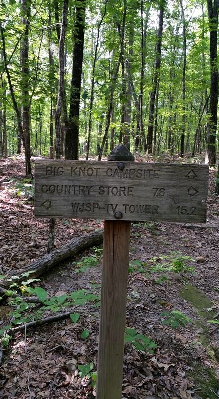
6) Big Knot Campsite - two fire rings (click here for more info)
From Fox Den Cove parking lot (Mile 6.2), go east on the PMT (north of GA Hwy 190 away from the parking lot). The hike to Big Knot takes you past a large rock cliff (Fox Den Cliff) near Indian Mountain. Down the slope away from the top of the mountain, the trail views to the west are spectacular…Just past sign for Turtle Hollow Campsite, coming from west, the trail crosses a small wooden bridge just before an uphill climb and trail to the right to the site. From Molly Hugger Hill Parking Lot you can hike west about 3 miles to the site (just west of the Mile 8 marker) The site is on small ridge. It has a/one metal fire ring. Water source is a small clear spring, which is located just at the bottom of the ridge to the east of the campsite about 100 yards or so.
7) Jenkins Spring Campsite (Click here for more info)
Established in October 2008, it is 3/10 of a mile east of Mile 8. From Fox Den Cove Parking Lot, hike east 2.1 miles. You will cross a small spring with bamboo on your right then the access trail to the campsite is just beyond that on your left (the north side of trail). From Mollyhugger Hill Parking Lot, hike west 2.8 miles. The access trail will thus be on your right then. Follow the white-blazed access trail across a small bridge to the site.
The water source is marked with a sign in the northwest corner of camp. The boundary of FDR State Park is approximately 200 yards north of the campsite. This is private property beyond the boundary. Please note the marks on the trees and stay within the park. There is now only ONE fire ring at the site. There is room for about 10 tents and up to 20 people.
8) Beech Bottom Campsite (click here for more info)
This site has one of the best water sources and right by the campsite. Directions: From Fox Den Cove Parking Lot (Mile 6.2 ) it is about 3 miles east. Just to the east of the Mile 9 marker, the trail runs alongside a stream and makes a slight turn uphill (east) and the campsite location sign is on the north side (left) of the trail. If you leave Molly Hugger Hill Parking Lot/Mile 11.2 and go west on the trail, you have about a two mile hike in. There is a 12 foot bridge over the water on the path leading off the PMT to the site on west side of the creek. The site is a flat cleared area under tree cover of Beech Trees. Be aware of the signs at the back (north side) of the site that mark the boundary of FDR State Park. The pines beyond there are GA State Parks property, but not to be hiked in to. The beautiful water source running alongside the camp is one of the best of all the campsites and can be counted on all year long.. There is now only ONE metal fire ring at the site. There is room for about 10 tents/hammocks and 20 people around the one fire ring. Trees for only couple hammocks. As with ALL sites-You must set up camp within about 50’ of the fire-ring.
9) Grindstone Gap Campsite - two fire rings (click here for more info)
Of the sixteen backcountry campsites, fourteen of them are located on the main Pine Mountain Trail. Grindstone Gap is located on the white-blazed Sawtooth Trail (Little Bridges is on the Chestnut Oak Trail). To get to Grindstone Gap, you can go west on the PMT (south of GA Hwy 190) from Fox Den Cove Parking Lot and then hike east on the Sawtooth Trail about 1.9 miles. If hiking from Mollyhugger Hill Parking Lot, go across GA 190 to the south and onto the PMT just a short ways, then hike right (west) on the Sawtooth Trail about 8/10 of a mile. The sign for Grindstone Gap Campsite, is located in a bottom. The site is several hundred feet off the trail to the south in a nice flat area. Water is not reliable in warmer months but is ok until late summer and runs right by the one fire ring. There is room for 10
tents or 20 people total.
10) Whiskey Still Campsite - one fire ring (click here for more info)
If you park at Mollyhugger Hill Parking Lot, and cross the road (south of GA Hwy 190) you are going east on the trail down the mountain. About .4 mile in you come to large rock and a sign on the right. Follow the site trail to the three tent sites on the hillside. This site was reworked in 1998-1999 as an Eagle Scout project. In 2001, Scouts reworked the access trail. There are only three tent sites and one fire ring just below the tent sites with a nice sitting area. Water: It is a 1/4 mile down a marked water trail to a small spring southwest of the site. There is the one fire ring at the camp, and room for only 3 tents.meaning only one person/couple or small group of about 6 will be issued a permit for this site.
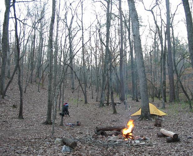
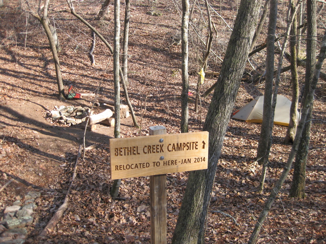
11) Bethel Creek Campsite - (click here for more info)
A great little campsite about in the middle of the Pine Mountain Trail….
On January 25, 2014 volunteers with the PMTA relocated Bethel Creek Campsite (in name) 2310 feet or about 4/10 of a mile east of the old location (east of Mile 13 marker 600’.) This is 737 feet west of the BootTop Trail/Pine Mountain Trail intersection. The original Bethel Creek Campsite location was wiped out in a 2011 tornado. The original site could not be maintained (nor had any tree cover). The site is located in sight of the Pine Mountain Trail a short distance off the trail, south side. There is only one fire-ring authorized here (so like all PMT backcountry campsites please don’t add fire-rings or move them.) There is downed wood near the site. With water nearby, campfires are permitted (unless a fire-ban park wide comes up.) The main Water source is a year-round spring-head, just 140' west of the campsite (just 27' off the trail), however in cooler months water flows past the camp itself under a walkway bridge. . Old Bethel Creek Campsite now has an engraved sign there by the trail noting it is closed (no camping or fires there). It was located 1,710' west of Mile 13. Note: on the PMTA map (2015 and newer) the site is located correctly. On 2013 and older editions of the map, the old site was/is shown west of Mile 13. Where the old campsite was, there on the 2015 map only (by mistake) is an unnamed tent symbol. There is only one fire ring at the new camp location, and again there is room for only 4 tents/or small group of about 8 at most will be issued a permit for this site.
Directions to the site: From the west once you pass Molly Hugger Hill Parking Lot (Mile 11.2) continue to travel east on the PMT past Mile 12, cross Hines Gap Road, through the tornado damage areas to just 600’ past Mile 13 to the site. Coming from Dowdell Knob Trailhead (Mile 14.5) come west past Mile 14 downhill on the trail, past the BootTop Trail intersection 737 feet on west to the site. There is a wooden sign by the trail leading off the PMT to the camp, and a brown thin Carsonite sign on the opposite side of trail with arrows pointing to the camp and down to the water source.
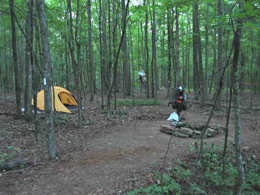
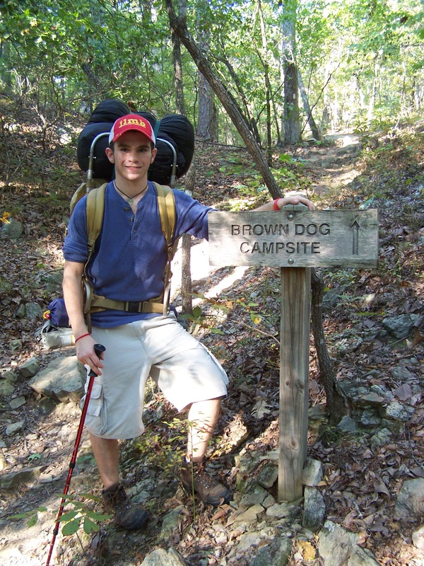
12 )Brown Dog Campsite – one fire ring (click here for more info) The campsite was first established in 1998. March 24th 2023 the camp was relocated to a smaller location just east of original location. The campsite is 100’ north of the trail just west of Mile 16. There is a wooden campsite sign on the north side of the trail and a brown strip sign on the south side. Uphill past the entrance signs about 100’ you find a nice flat area and ONE metal fire ring. There is an ample amount of dead wood near the site. To get to Brown Dog Campsite you can hike in from the Dowdell Knob area east about 1.5 miles or park at Rocky Point Parking Lot and hike in west about 2.1 miles. You can also hike in east from the Boot Top Trail Parking Area, on the white blazed Boot Top Trail just .6 of a mile (to the end of it), then turn right/west onto the blue blazed main PMT to just past Mile 16.. There is room for about 4-5 tents at most and you must set up within 50’ of the fire ring. There are places for 2 hammocks. DO NOT add rocks around the metal fire ring nor move it and even though the metal fire ring has a cooking grate, still NO CHARCOAL use in the backcountry (it doesn’t go away, just use dead downed wood).
13) Sparks Creek Campsite - (click here for more info)
The campsite is on Sparks Creek, just west of Mile 17 about 1/10 of a mile. Directions: The hike west in from Rocky Point/Mile 18 is the best (it is about 1.1 miles.) The trail comes down through the cliffs at Rocky Point and it’s downhill all the way. Just west of Mile 17; the trail turns left and you cross Sparks Creek on stepping stones and the trail continues along the stream a short ways, then uphill about 100 yards to the signs that mark the campsite on the left. Take the short access trail downhill from there to the site. Coming east off Hornet Knob (from Dowdell's Knob area), you reach the site at the end of some gentle switch backs at the bottom of the hill. Signs on the Pine Mountain Trail point slightly down hill to the camp. There is a sign about 100' down into the camp on your right pointing to a bridge you cross to get to the camp area with room for 8 tents. There is only ONE fire ring at the site now. The year-round water source for the camp is flowing spring about 50’ from the fire ring area. The site was relocated May 17, 2014 and again in June of 2020. The old fire ring areas had become so compacted from use over the years and “bad campers” had cut down numerous trees including all the dogwoods. One of the main sources of compaction is not just a site being used, but campers NOT fluffing up the leaves where they had put their tents and hammocks when they get ready to leave a camp. The current fire ring site area has trees close enough for maybe two hammocks at most. Watch for signs showing the boundary of the park to the south and noting the closure of the old fire rings. Tents/hammocks like all sites need to be set up within 50’ of the fire ring.
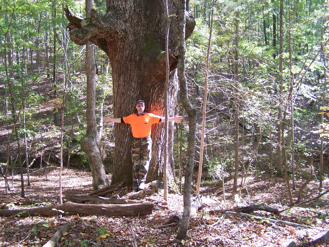
14) Big Oak Springs Campsite - one fire ring (click here for more info)
The access trail to Big Oak Springs Campsite, starts off the Pine Mountain Trail about .8 of a mile west of Rocky Point Parking Lot/Mile 18. If you are coming east from say Dowdell's Knob the site entrance sign is just about 500’ east of the PMT Mile 17 marker (which is east of nearby Sparks Creek Campsite). This campsite holds about 16 people and 8 tents. Follow the white blazed access trail off the PMT 495 feet down to the main part of the camp and the one metal fire ring (installed 6/24/2023). The water source for the camp is further down the access trail just 250 feet, and downhill to the spring stream. Across the spring stream is evidence of two “whiskey stills.” Above the spring you will see a HUGE white oak tree that fell in the fall of 2020….Before it fell, it was why we named the site Big Oak Springs. NOTE: Please place tents ONLY near the fire ring, as to the right of the water source trail are red signs warning no placing tents near the historic old house-place rock piles. There are signs on the west side of the camp telling of no camping there (again, an old historic house foundation area and former/now closed off campsite location.)
15) Sassafras Hill Campsite - (click here for more info)
Most hike to the campsite starting in from the WJSP-TV tower/Mile 23 trailhead. Hiking west on the trail some 4.6 miles to the site. You can also take an easy hike in from Rocky Point Parking Lot (cross Ga. 190 from the parking lot) and head east some 4/10 of a mile. West of the camp , just before the site is small wooden bridge that you cross and continue uphill on the blue-blazed PMT to the site on the left. There is usually (but not reliable) water available there by the bridge except in the summer. The site is located on a flat hill top. This was a larger site and was a favorite of scout units in the past but be aware it is NOT suggested for group use now as it smaller and there is not water reliable nearby most times during warmer months west and east of the site for the last couple years (only some runoff water after a rain. ) Since Sassafras Hill has NO reliable water nearby it is now considered by the FDR park manager as a dry camp and NO campfires allowed there unless you are told otherwise upon arrival to obtain your backcountry permit at the park office. Best would be careful use of stoves only there for now. There is only one fire- ring at the site to use when fires are acceptable to be built. There is room for maybe about 8 tents 16 people total but they must set up within about 50’ of the fire ring. Really not but two trees close enough for one hammock there.
16) Old Sawmill Campsite (click here for more info) As you come off the Pine Mountain Trail at the campsite sign, a few feet away are signs noting NO CAMPING BEYOND THIS SIGN. This area was the old campsite area....Look to the left about 50' and there is a brown Carsonite sign pointing uphill and to the left. It is about 200' to the campsites present location. . There is now only ONE metal fire ring at the site. Most people hike in to this site area from the Mile 23/ WJSP-TV tower parking lot trailhead (about 2.7 miles). The hike in to Old Sawmill is one of the most scenic, with lots of hiking over water crossings and hills, past cliffs and waterfalls including Cascade Falls. An alternate route is hiking in from the west, and it is about 2.3 miles east of Mile 18/Rocky Point Parking Lot trailhead. The site has the best water source along the trails. This being a good-sized stream alongside the trail, at the campsite trail entrance. The best access point to the stream is noted with a sign, just 75 feet east past the entrance to the camp where the bank is less steep. .
17) Bumble Bee Ridge Campsite - (click here for more info)
Most people hike in to this site west from the WJSP-TV tower/Mile 23 trailhead. The site is located at the end of a fairly steep switchback uphill climb just past Slippery Rock Falls, about 1.6 miles in. If hiking east from say Rocky Point/Mile 18 it is 3.4 miles. The water source is way back down the trail at the bottom of the hill east of the camp at Slippery Rock Falls or way further down hill to the west . Good idea to get water as you pass the water sources......Please stay on the marked blue-blazed trail in and near the campsite area if going back for water. Note: if you have a campfire, be prepared to haul about 2-3 gallons of water up the hill to put out the fire (or don't have a fire.) Remember, if you have a fire at night and not in the morning you still need to drown the likely smoldering coals in the ashes! We of the PMTA (and park rangers) have found way too many smoldering campfires at this camp due to folks not willing to haul water up to drown their fire. This site is checked often by us. There is now only ONE metal fire ring at the site. Fire ring is for wood use only. NO CHARCOAL. There is room for 8 tents or combination of tents and hammocks or 16 backpackers (room/trees for 2-3 hammocks). DO NOT set up camp in the old area marked "NO CAMPING CLOSED FOR RESTORATION" area.
you arrive at the park office.IMPORTANT: you must be off the trail hiking to sites before dark.
Each campsite is slightly different in size and capacity. Once you obtain your permit for the named sites, you must stay at the site or sites listed on your permit. Should you decide to NOT stay at a site, let the park office or rangers know. What happens if you say “poop out” and get to say Sparks Creek Campsite
and no one it there, and you have a permit for Brown Dog? You may call the park office during office hours and request (if available/ not permitted out) to stay at Sparks and clerks may change your permit verbally. Again, this must be done (call/seek permission during office hours) before you change sites..
Please do NOT move a fire-ring, add to/alter or build new ones. You must set up camp (tents and hammocks) near/within 50’ of the fire-ring. Build fires with dead, down on the ground wood: no cutting/sawing/carving of or on any size standing trees, dead or living. What do you do if you want to cook hot-dogs or roast marshmallows? Bring a skewer from home! Whiskey Still, Sassafras Hill and Grindstone Gap have little if any water nearby during warmer months. Be very cautious if you have a campfire at those sites and drown all campfires with about 3 gallons of water (if there is no water nearby, no campfire). Sassafras Hill Campsite does not have water nearby often.
Ga State Park rules state NO alcohol consumption at all in the park except inside rental cabins & RV’s, so there is no drinking period in the backcountry (along the trail and campsites) nor at road side picnic areas and trailheads. If you need to cut up small dead/downed wood, bring a small folding hand saw. Pack out all your trash and help by taking out any left by others. NOTE: if you come to a campsite and find trash/left equipment in the camp or a smoldering fire, PLEASE call the park emergency number to inform the manager/ranger on duty (text/send them photos if requested and help by cleaning up trash if possible). Also call and send photos of same to Jim Hall with PMTA at 706-325-4113 or email to pinemttrailassoc._jim@msn.com .....NOTE: If you leave a campsite with trash or smoldering fire, you can be assumed to have left it and as the last permitted person there can be cited. Campsites are regularly checked by park rangers and PMTA volunteers. Lastly, don’t build nor leave ANY “wilderness beds”/tables etc.” Leave a site better than you find it. PLEASE only burn wood in a campfire and don’t try to melt down/burn any aluminum foil, metal cans, glass, plasticware (they are trash and haul it out.) No CHARCOAL either as it does not burn down well. Please don’t put candles on rocks by campfires either. At the time you obtain your backcountry permit, you will be offered a trash bag if you don’t have one.
Here is a link to one page of information on Backcountry Camping you may want to review as an individual/couple or pass along to those coming with you in a group.
While reading these descriptions, it is best to have an actual PMT topo style map in front of you. Maps are available from the PMTA on this website and the park office..
1) Little Bridges Campsite - one fire ring (click here for more info)
This campsite is located on the Chestnut Oak Trail just off the main PMT. You can get to this site from the west end of the Chestnut Oak Trail by parking across from the Gardens Country Store, hiking up Ga 190 a short ways to the rock wall entrance way of FDR State Park on the left. The Pine Mountain Trail sign is on the south side of the road on the right. Look for a sign for the Chestnut Oak Trail on your left (north side of the road). Hike the Chestnut Oak Trail east 1.7 miles to the campsite. (The entire Chestnut Oak Trail is 2.1 miles long.) OPTION: If you start off on the main PMT and come to Mile 1.4 at the Garden Overlook Parking Area, you cross GA Hwy 190 to the north. Just after you cross the road, there is a junction with the white blazed Chestnut Oak Trail that goes to your left (west). Little Bridges Campsite is located just down the mountain 4/10 mile from this junction. Large hardwoods are all around this beautiful camp. This camp was built to allow backpackers a close first or last night's camp. The distance to GA 190 will make it a good choice for first time backpackers or those with younger campers. There is a nice year-round spring beside the camp entrance that runs under a little bridge. This is a single fire ring site.
2) Dead Pine Campsite (click here for more info)
This is the first site on the main PMT starting from the west end. The site is located east past Mile 2 about 4/10 of a mile. You can also hike to the campsite from "No Name Parking Lot" which is only about a one half mile hike. From "No Name Parking Lot" there is a sign directing you to the Pine Mountain Trail via a dirt road off/away from the parking lot. After hiking this road a short ways you will pass the red blazed Mountain Creek Trail (which crosses the road) and you continue on uphill until you see the wooden Pine Mountain Trail directional sign. Turn right (west) there onto the blue blazed PMT. You will pass over the dam of the large CCC Hatchery Pond and continue on until you see the campsite sign on your right. From there to the camp is a white blazed 265' trail. The water source is from a spring some 370' from the campsite via a marked trail with sign. There is just one metal fire ring at the area of the campsite. The old main campsite area is noted a being closed off to allow regeneration due to compaction/bare ground. This site is a 5 tent 10 person site, and has a number of trees which is good for hammock campers. NOTE: DO NOT add rocks around the metal fire ring nor move it and even though the metal fire ring has a cooking grate, still NO CHARCOAL use in the backcountry (it doesn’t go away, just use dead downed wood).
3) Broken Tree Campsite - one fire ring (click here for more info)
This campsite is located 1.4 miles east from the FDR Park Office on the main PMT. On this route you cross paved roads twice before you reach the camp just east past Mile 5 marker. If you park at Fox Den Cove Parking Lot, cross GA 190 and follow the PMT back to the west. Broken Tree Campsite is 6/10 of a mile west of Mile 6. The camp is on south side of the trail (heading east) in a small bottom just before you start back uphill. There is wooden sign on your right. This is a small camp for three tents at the most. In winter this is a warm camp, as a hill north of it should block the wind. There is an ample supply of downed, dead wood for campfires. There is a year-round spring right on the edge of the camp. This is a single fire ring site, meaning only one person/couple or small group of about 6 will be issued a permit for this 3 tent site.
4 & 5) Turtle Hollow & Turtle Bluff Campsites - one fire ring at each (click here for more info)
The start of the access trail to Turtle Hollow Campsite is 1.4 miles east of Fox Den Cove Parking Lot on the Pine Mountain Trail. From Molly Hugger Hill Parking Lot it is about 3.6 miles west. There is a wooden sign and brown strip sign at the head of the of the access trail to the camp off the PMT. Follow the white blazed access trail down west some 780’ to another wooden sign. To the right of this sign is the main campsite which can accommodate a large group of backpackers (12-15 tents or around 30+ backpackers) but there is only one established fire ring. Water for this group size camp is a small spring stream that runs by the camp under the nearby bridge.
For 1-4 people with 2 tents max use Turtle Bluff. At the sign is a footbridge. Cross the bridge and follow the trail up a short ways to Turtle Bluff. This small sub-camp, overlooks the spring stream below. There is room for only two tents and again there is one established fire ring there. Even if there is a group staying at the main Turtle Hollow Campsite, Turtle Bluff is across the spring and up the hill enough to offer “privacy” for backpackers away from a group at the main campsite.
6) Big Knot Campsite - two fire rings (click here for more info)
From Fox Den Cove parking lot (Mile 6.2), go east on the PMT (north of GA Hwy 190 away from the parking lot). The hike to Big Knot takes you past a large rock cliff (Fox Den Cliff) near Indian Mountain. Down the slope away from the top of the mountain, the trail views to the west are spectacular…Just past sign for Turtle Hollow Campsite, coming from west, the trail crosses a small wooden bridge just before an uphill climb and trail to the right to the site. From Molly Hugger Hill Parking Lot you can hike west about 3 miles to the site (just west of the Mile 8 marker) The site is on small ridge. It has a/one metal fire ring. Water source is a small clear spring, which is located just at the bottom of the ridge to the east of the campsite about 100 yards or so.
7) Jenkins Spring Campsite (Click here for more info)
Established in October 2008, it is 3/10 of a mile east of Mile 8. From Fox Den Cove Parking Lot, hike east 2.1 miles. You will cross a small spring with bamboo on your right then the access trail to the campsite is just beyond that on your left (the north side of trail). From Mollyhugger Hill Parking Lot, hike west 2.8 miles. The access trail will thus be on your right then. Follow the white-blazed access trail across a small bridge to the site.
The water source is marked with a sign in the northwest corner of camp. The boundary of FDR State Park is approximately 200 yards north of the campsite. This is private property beyond the boundary. Please note the marks on the trees and stay within the park. There is now only ONE fire ring at the site. There is room for about 10 tents and up to 20 people.
8) Beech Bottom Campsite (click here for more info)
This site has one of the best water sources and right by the campsite. Directions: From Fox Den Cove Parking Lot (Mile 6.2 ) it is about 3 miles east. Just to the east of the Mile 9 marker, the trail runs alongside a stream and makes a slight turn uphill (east) and the campsite location sign is on the north side (left) of the trail. If you leave Molly Hugger Hill Parking Lot/Mile 11.2 and go west on the trail, you have about a two mile hike in. There is a 12 foot bridge over the water on the path leading off the PMT to the site on west side of the creek. The site is a flat cleared area under tree cover of Beech Trees. Be aware of the signs at the back (north side) of the site that mark the boundary of FDR State Park. The pines beyond there are GA State Parks property, but not to be hiked in to. The beautiful water source running alongside the camp is one of the best of all the campsites and can be counted on all year long.. There is now only ONE metal fire ring at the site. There is room for about 10 tents/hammocks and 20 people around the one fire ring. Trees for only couple hammocks. As with ALL sites-You must set up camp within about 50’ of the fire-ring.
9) Grindstone Gap Campsite - two fire rings (click here for more info)
Of the sixteen backcountry campsites, fourteen of them are located on the main Pine Mountain Trail. Grindstone Gap is located on the white-blazed Sawtooth Trail (Little Bridges is on the Chestnut Oak Trail). To get to Grindstone Gap, you can go west on the PMT (south of GA Hwy 190) from Fox Den Cove Parking Lot and then hike east on the Sawtooth Trail about 1.9 miles. If hiking from Mollyhugger Hill Parking Lot, go across GA 190 to the south and onto the PMT just a short ways, then hike right (west) on the Sawtooth Trail about 8/10 of a mile. The sign for Grindstone Gap Campsite, is located in a bottom. The site is several hundred feet off the trail to the south in a nice flat area. Water is not reliable in warmer months but is ok until late summer and runs right by the one fire ring. There is room for 10
tents or 20 people total.
10) Whiskey Still Campsite - one fire ring (click here for more info)
If you park at Mollyhugger Hill Parking Lot, and cross the road (south of GA Hwy 190) you are going east on the trail down the mountain. About .4 mile in you come to large rock and a sign on the right. Follow the site trail to the three tent sites on the hillside. This site was reworked in 1998-1999 as an Eagle Scout project. In 2001, Scouts reworked the access trail. There are only three tent sites and one fire ring just below the tent sites with a nice sitting area. Water: It is a 1/4 mile down a marked water trail to a small spring southwest of the site. There is the one fire ring at the camp, and room for only 3 tents.meaning only one person/couple or small group of about 6 will be issued a permit for this site.
11) Bethel Creek Campsite - (click here for more info)
A great little campsite about in the middle of the Pine Mountain Trail….
On January 25, 2014 volunteers with the PMTA relocated Bethel Creek Campsite (in name) 2310 feet or about 4/10 of a mile east of the old location (east of Mile 13 marker 600’.) This is 737 feet west of the BootTop Trail/Pine Mountain Trail intersection. The original Bethel Creek Campsite location was wiped out in a 2011 tornado. The original site could not be maintained (nor had any tree cover). The site is located in sight of the Pine Mountain Trail a short distance off the trail, south side. There is only one fire-ring authorized here (so like all PMT backcountry campsites please don’t add fire-rings or move them.) There is downed wood near the site. With water nearby, campfires are permitted (unless a fire-ban park wide comes up.) The main Water source is a year-round spring-head, just 140' west of the campsite (just 27' off the trail), however in cooler months water flows past the camp itself under a walkway bridge. . Old Bethel Creek Campsite now has an engraved sign there by the trail noting it is closed (no camping or fires there). It was located 1,710' west of Mile 13. Note: on the PMTA map (2015 and newer) the site is located correctly. On 2013 and older editions of the map, the old site was/is shown west of Mile 13. Where the old campsite was, there on the 2015 map only (by mistake) is an unnamed tent symbol. There is only one fire ring at the new camp location, and again there is room for only 4 tents/or small group of about 8 at most will be issued a permit for this site.
Directions to the site: From the west once you pass Molly Hugger Hill Parking Lot (Mile 11.2) continue to travel east on the PMT past Mile 12, cross Hines Gap Road, through the tornado damage areas to just 600’ past Mile 13 to the site. Coming from Dowdell Knob Trailhead (Mile 14.5) come west past Mile 14 downhill on the trail, past the BootTop Trail intersection 737 feet on west to the site. There is a wooden sign by the trail leading off the PMT to the camp, and a brown thin Carsonite sign on the opposite side of trail with arrows pointing to the camp and down to the water source.
12 )Brown Dog Campsite – one fire ring (click here for more info) The campsite was first established in 1998. March 24th 2023 the camp was relocated to a smaller location just east of original location. The campsite is 100’ north of the trail just west of Mile 16. There is a wooden campsite sign on the north side of the trail and a brown strip sign on the south side. Uphill past the entrance signs about 100’ you find a nice flat area and ONE metal fire ring. There is an ample amount of dead wood near the site. To get to Brown Dog Campsite you can hike in from the Dowdell Knob area east about 1.5 miles or park at Rocky Point Parking Lot and hike in west about 2.1 miles. You can also hike in east from the Boot Top Trail Parking Area, on the white blazed Boot Top Trail just .6 of a mile (to the end of it), then turn right/west onto the blue blazed main PMT to just past Mile 16.. There is room for about 4-5 tents at most and you must set up within 50’ of the fire ring. There are places for 2 hammocks. DO NOT add rocks around the metal fire ring nor move it and even though the metal fire ring has a cooking grate, still NO CHARCOAL use in the backcountry (it doesn’t go away, just use dead downed wood).
13) Sparks Creek Campsite - (click here for more info)
The campsite is on Sparks Creek, just west of Mile 17 about 1/10 of a mile. Directions: The hike west in from Rocky Point/Mile 18 is the best (it is about 1.1 miles.) The trail comes down through the cliffs at Rocky Point and it’s downhill all the way. Just west of Mile 17; the trail turns left and you cross Sparks Creek on stepping stones and the trail continues along the stream a short ways, then uphill about 100 yards to the signs that mark the campsite on the left. Take the short access trail downhill from there to the site. Coming east off Hornet Knob (from Dowdell's Knob area), you reach the site at the end of some gentle switch backs at the bottom of the hill. Signs on the Pine Mountain Trail point slightly down hill to the camp. There is a sign about 100' down into the camp on your right pointing to a bridge you cross to get to the camp area with room for 8 tents. There is only ONE fire ring at the site now. The year-round water source for the camp is flowing spring about 50’ from the fire ring area. The site was relocated May 17, 2014 and again in June of 2020. The old fire ring areas had become so compacted from use over the years and “bad campers” had cut down numerous trees including all the dogwoods. One of the main sources of compaction is not just a site being used, but campers NOT fluffing up the leaves where they had put their tents and hammocks when they get ready to leave a camp. The current fire ring site area has trees close enough for maybe two hammocks at most. Watch for signs showing the boundary of the park to the south and noting the closure of the old fire rings. Tents/hammocks like all sites need to be set up within 50’ of the fire ring.
14) Big Oak Springs Campsite - one fire ring (click here for more info)
The access trail to Big Oak Springs Campsite, starts off the Pine Mountain Trail about .8 of a mile west of Rocky Point Parking Lot/Mile 18. If you are coming east from say Dowdell's Knob the site entrance sign is just about 500’ east of the PMT Mile 17 marker (which is east of nearby Sparks Creek Campsite). This campsite holds about 16 people and 8 tents. Follow the white blazed access trail off the PMT 495 feet down to the main part of the camp and the one metal fire ring (installed 6/24/2023). The water source for the camp is further down the access trail just 250 feet, and downhill to the spring stream. Across the spring stream is evidence of two “whiskey stills.” Above the spring you will see a HUGE white oak tree that fell in the fall of 2020….Before it fell, it was why we named the site Big Oak Springs. NOTE: Please place tents ONLY near the fire ring, as to the right of the water source trail are red signs warning no placing tents near the historic old house-place rock piles. There are signs on the west side of the camp telling of no camping there (again, an old historic house foundation area and former/now closed off campsite location.)
15) Sassafras Hill Campsite - (click here for more info)
Most hike to the campsite starting in from the WJSP-TV tower/Mile 23 trailhead. Hiking west on the trail some 4.6 miles to the site. You can also take an easy hike in from Rocky Point Parking Lot (cross Ga. 190 from the parking lot) and head east some 4/10 of a mile. West of the camp , just before the site is small wooden bridge that you cross and continue uphill on the blue-blazed PMT to the site on the left. There is usually (but not reliable) water available there by the bridge except in the summer. The site is located on a flat hill top. This was a larger site and was a favorite of scout units in the past but be aware it is NOT suggested for group use now as it smaller and there is not water reliable nearby most times during warmer months west and east of the site for the last couple years (only some runoff water after a rain. ) Since Sassafras Hill has NO reliable water nearby it is now considered by the FDR park manager as a dry camp and NO campfires allowed there unless you are told otherwise upon arrival to obtain your backcountry permit at the park office. Best would be careful use of stoves only there for now. There is only one fire- ring at the site to use when fires are acceptable to be built. There is room for maybe about 8 tents 16 people total but they must set up within about 50’ of the fire ring. Really not but two trees close enough for one hammock there.
16) Old Sawmill Campsite (click here for more info) As you come off the Pine Mountain Trail at the campsite sign, a few feet away are signs noting NO CAMPING BEYOND THIS SIGN. This area was the old campsite area....Look to the left about 50' and there is a brown Carsonite sign pointing uphill and to the left. It is about 200' to the campsites present location. . There is now only ONE metal fire ring at the site. Most people hike in to this site area from the Mile 23/ WJSP-TV tower parking lot trailhead (about 2.7 miles). The hike in to Old Sawmill is one of the most scenic, with lots of hiking over water crossings and hills, past cliffs and waterfalls including Cascade Falls. An alternate route is hiking in from the west, and it is about 2.3 miles east of Mile 18/Rocky Point Parking Lot trailhead. The site has the best water source along the trails. This being a good-sized stream alongside the trail, at the campsite trail entrance. The best access point to the stream is noted with a sign, just 75 feet east past the entrance to the camp where the bank is less steep. .
17) Bumble Bee Ridge Campsite - (click here for more info)
Most people hike in to this site west from the WJSP-TV tower/Mile 23 trailhead. The site is located at the end of a fairly steep switchback uphill climb just past Slippery Rock Falls, about 1.6 miles in. If hiking east from say Rocky Point/Mile 18 it is 3.4 miles. The water source is way back down the trail at the bottom of the hill east of the camp at Slippery Rock Falls or way further down hill to the west . Good idea to get water as you pass the water sources......Please stay on the marked blue-blazed trail in and near the campsite area if going back for water. Note: if you have a campfire, be prepared to haul about 2-3 gallons of water up the hill to put out the fire (or don't have a fire.) Remember, if you have a fire at night and not in the morning you still need to drown the likely smoldering coals in the ashes! We of the PMTA (and park rangers) have found way too many smoldering campfires at this camp due to folks not willing to haul water up to drown their fire. This site is checked often by us. There is now only ONE metal fire ring at the site. Fire ring is for wood use only. NO CHARCOAL. There is room for 8 tents or combination of tents and hammocks or 16 backpackers (room/trees for 2-3 hammocks). DO NOT set up camp in the old area marked "NO CAMPING CLOSED FOR RESTORATION" area.